Segmentation and VB width
Summary
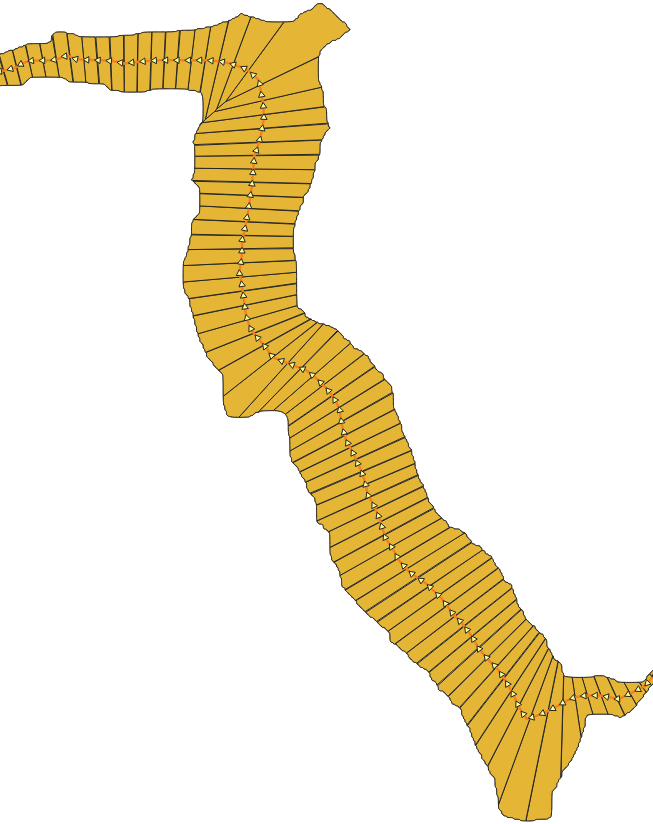
Disaggregate fluvial units (polygons or polylines) in DGO of chosen size. Output contains Polygon Width by DGO if the segmented feature was a Polygon.
Tags:dgo, polygon, polyline, segmentation, transect, vector, disaggregation, centerline, width, valley bottom
Usage
Prior to assess metrics to characterize a fluvial system, fluvial units have to be disaggregated (Roux et al., 2014)1. This step enables to discretize a continuum with a constant length in order to provide a higher resolution for characterizing fluvial units. The constant length must be set precisely to ensure spatial trends or relationships between several variables to be correctly detected either at a network scale or at a local scale. Spatial disaggregation can be run both for linear (e.g. hydrographic network, centerline) and polygon feature (valley bottom, active channel).
Algorithm:
if input type is polyline
  run segmentize algorithm

elif input type is polygon
  if a centerline is provided
    calculate a AXIS FID field on centerline
    run disaggregate polygon algorithm
For more details on the disaggregation process, please refer to the Disaggregate Polygon documentation.
Parameters
| Parameter | Description | Type |
|---|---|---|
Input features to segment
INPUT
|
The feature to be segmented | Polygon, MultiPolygon, LineString or MultiLineString |
Centerline of the polygon to segment
CENTERLINE
(Optional)
|
Useful in case of a polygon feature to segment and relates to the centerline of this input feature. | LineString or MultiLineString |
Segmentation step
STEP
|
User-defined constant length used to disaggregate
the input feature (in map unit).
Default value: 25.0
|
Number |
Segmented features
OUTPUT
|
The segmented output feature. | Polygon or LineString (depend of input type) |
See Also
-
Roux, C., Alber, A., Bertrand, M., Vaudor, L., & Piégay, H. (2014). “FluvialCorridor”: A new ArcGIS toolbox package for multiscale riverscape exploration. Geomorphology. https://doi.org/10.1016/j.geomorph.2014.04.018 ↩