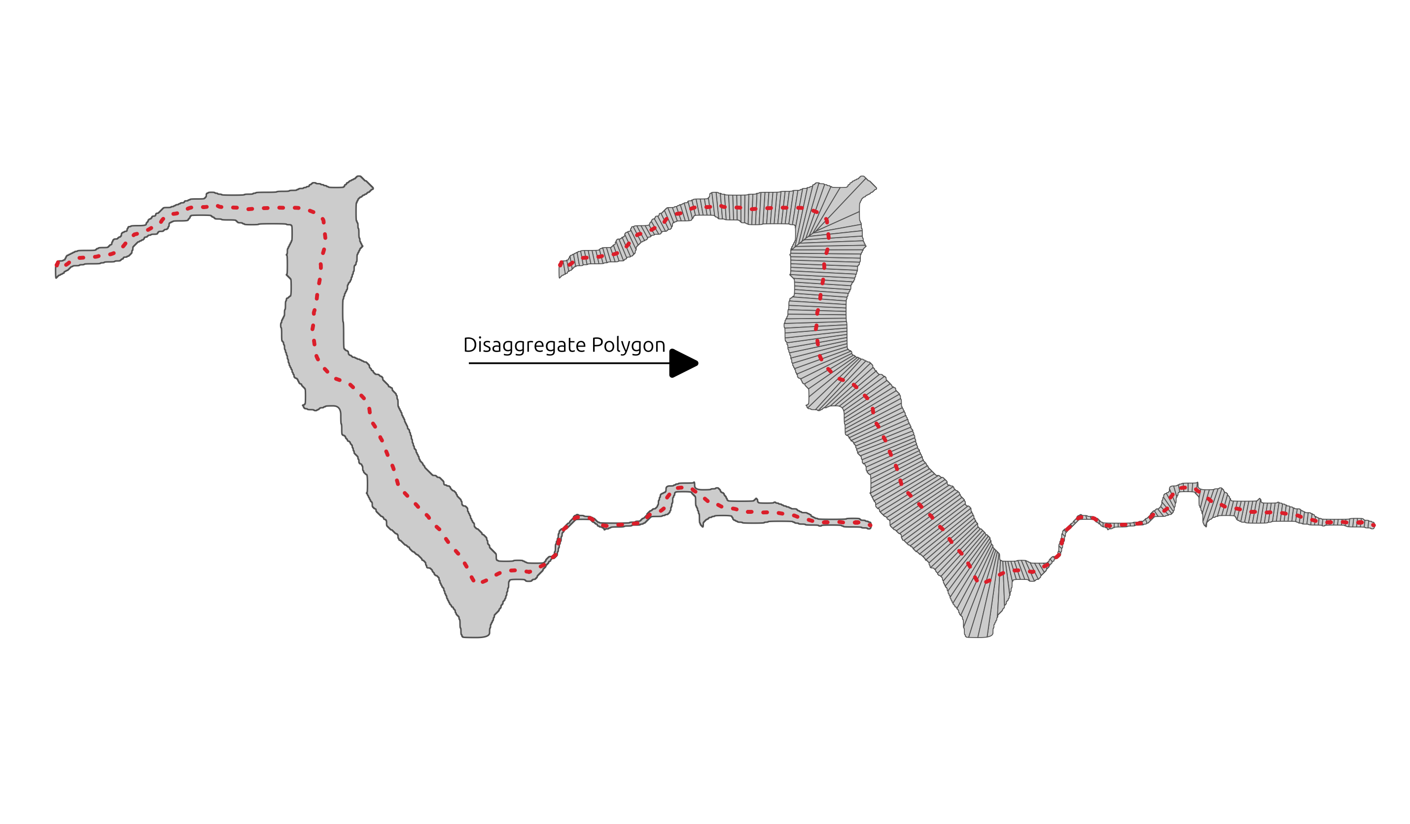
Disaggregate Polygon
Summary
Disaggregation of an input polygon (ex. valley bottom) along a centerline. Please note that the DGO_WIDTH value is only valid if you used the centerline of the polygon.
Tags:vector, DGO, disaggregation, model, voronoi
Usage
Disaggregation in DGOs (Disaggregated Geographic Objects) of an input polygon (ex. valley bottom) along a centerline.

Prior to assess metrics to characterize a fluvial system, fluvial units have to be disaggregated (Roux et al., 2014)1. This step enables to discretize a continuum with a constant length in order to provide a higher resolution for characterizing fluvial units. The constant length must be set precisely to ensure spatial trends or relationships between several variables to be correctly detected either at a network scale or at a local scale.
The disaggregation process is based on delaunay triangulation around regularly spaced points along the centerline. The width of the DGOs are calculated using the following algorithm:
place a point every STEP/10 along the polygon ring (so approximately 10 points are placed per DGO per side)

for each point:
  find the nearest DGO center point
  calculate the distance between the two points
  multiply this distance by 2

for each DGO:
  find all associated points along the polygon ring
  calculate the mean of the distances between the DGO center point and the associated points
This width is only an approximation and meaningful if the polyline supplied is the centerline of the disaggregated polygon.
Parameters
| Parameter | Description | Type |
|---|---|---|
Centerline of the polygon
CENTERLINE
|
Centerline of the polygon to disaggregate | LineString |
Polygon to disaggregate
POLYGON
|
Polygon to disaggregate (ex. valley bottom) | Polygon |
Disaggregation distance
STEP
|
Size of the output DGOs (in map unit along the centerline)
Default value: 100.0
|
Number |
Disaggregated polygon
DISAGGREGATED
|
Output DGOs with the following fields: - DGO_FID: unique identifier of the DGO - DISTANCE: position of the DGO along the centerline - DGO_WIDTH: approximation of the DGO width | Polygon |
See Also
-
Roux, C., Alber, A., Bertrand, M., Vaudor, L., & Piégay, H. (2014). “FluvialCorridor”: A new ArcGIS toolbox package for multiscale riverscape exploration. Geomorphology. https://doi.org/10.1016/j.geomorph.2014.04.018 ↩

